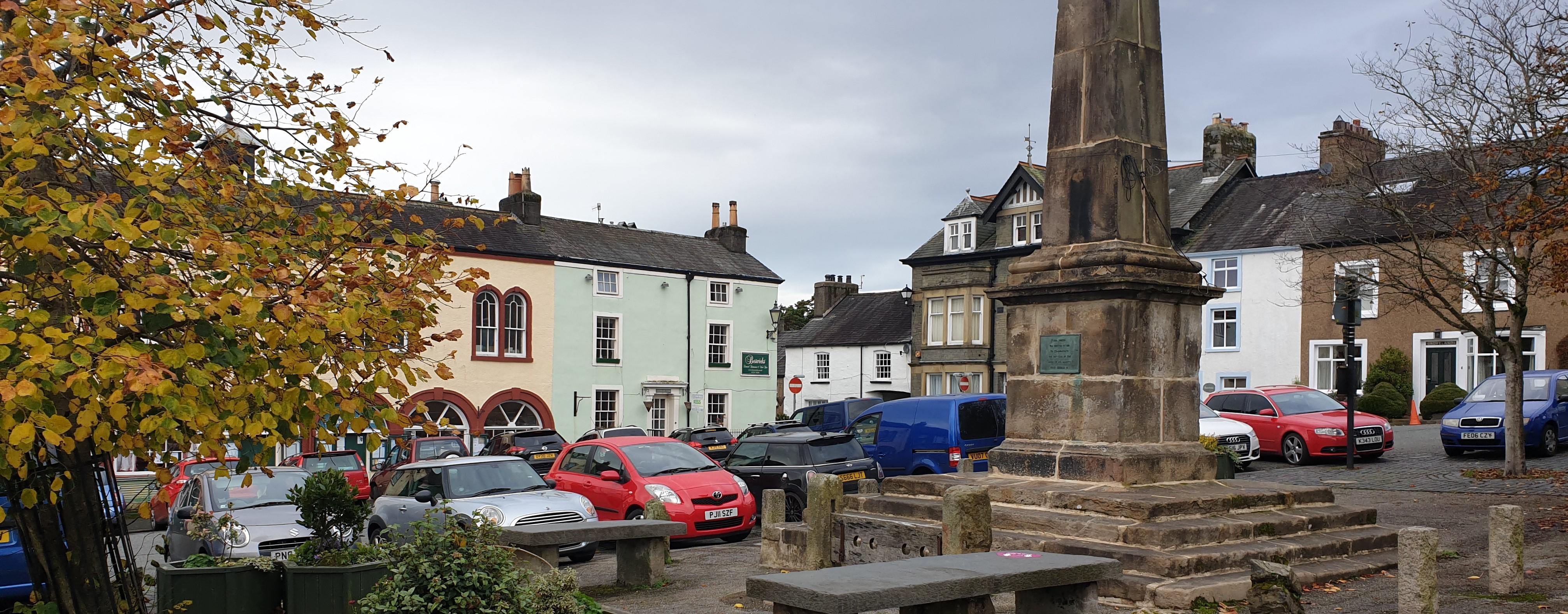
All about the amazing Duddon parish council home page
Duddon Parish Council Home Page
OgImage:
  • Duddon Square

    Welcome To The Parish Website

Welcome to Duddon Parish Council

The Organisation

Duddon Parish is situated in South West Cumbria, mainly within the Lake District National Park, and was formed in 1976 to incorporate the old parishes of Broughton West, Seathwaite with Dunnerdale and Angerton.

The Parish

The Parish stretches from the summit of Wrynose Pass in the North to the Duddon Estuary on Morecambe Bay in the South.

Broughton-in-Furness
The main town within the parish is the small ancient market town of Broughton-in-Furness, which has a Charter dating back to 1575. 

The Valleys
Contained within the wide boundaries of the parish are the Duddon Valley, much beloved by Wordsworth, the secluded Lickle Valley, the beautiful Woodland Valley and the marshes of Angerton on the Duddon Estuary.

The Communities
The main hamlets in these valleys comprise Woodland, Broughton Mills, Ulpha, Dunnerdale, Seathwaite, Cockley Beck & Angerton.

Latest Parish News

Temp Road Closure

Broughton-in-Furness

06

October 2026
temp road closure

A temporary road closure has been put in place to allow Westmorland and Furness Highways to carry out highway works which are expected to commence 14th October 2026 and anticipated to take 8 days to complete.

Please see below details of the extents of the restriction(s) and any alternative route(s) which may be in place, the relevant legal notice can be viewed at https://api-gb.one.network/downloads/tm/4587/reactivation-notice-w-f_152741506_4235543_7982280eac.pdf and a location plan clearly showing these extents can be found on one.network via link https://one.network/?tm=GB152741506

Location:

1. Church Street, from its junction with the A593, extending in a overall south easterly direction to its junction with Griffin Street.

2. Griffin Street, from its junction with Church Street, extending in a north easterly direction to its junction with Market Street.

3. Prince's Street, from its junction with Griffin Street, extending in a south easterly direction to its junction with Station Road.

Alternative Route: A suitable alternative route will be signed and made available via the C5009, A595 and the unrestricted section of the C5051. It has been identified that it will not be safe to maintain access for pedestrians and dismounted cyclists throughout the restriction.

N.B Passage for Emergency Vehicles will not be maintained for the duration of this restriction.

Duddon Bridge Temp road closure

23

July 2026
road closure

A temporary road closure has been put in place to allow Fibrus Networks Gb to carry out utility works which are expected to commence 5th August 2026 and anticipated to take 8 days to complete.

Please see below details of the extents of the restriction(s) and any alternative route(s) which may be in place, the relevant legal notice can be viewed at https://api-gb.one.network/downloads/tm/4587/site-notice_3ba295dbe0.pdf and a location plan clearly showing these extents can be found on one.network via link https://one.network/?tm=GB150379871

Location: C5008 Duddon Bridge, from its junction with the U5038, extending in a north easterly then north westerly direction to its junction with the C4028.

Alternative Route: A suitable alternative route will be signed and made available via the unrestricted section of the C5088, A593, A595, Smithy Lane, Stella Brow and the C4028. A way for pedestrians and dismounted cyclists will be maintained at all times.

N.B Passage for Emergency Vehicles will be maintained where required for the duration of this restriction.

Should you have any queries in relation to this temporary Order please contact the Highways Hotline by calling 0300 373 3306 or via the Westmorland & Furness Council website, quoting the reference TTROW/19632

Duddon Parish Council
°C
Weather Humidity percentage %
mph
Weather Description
FRI Weather Day One ° °
SAT Weather Day two ° °
SUN Weather Day three ° °
MON Weather Day four ° °
TUE Weather Day five ° °